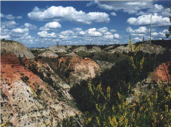
These fair weather cumulus clouds in Theodore Roosevelt National Park, are low clouds. The bottoms of these clouds are at the elevation where the rising (and cooling) air reaches the dewpoint.
CLOUDS:
Knowing about clouds is not part of the Minnesota standards for teachers
of grades 5-8, and so is not included as part of this class. However,
clouds are something that younger students can notice and think about.
If you know something about the different kinds of clouds, you can help
them notice different features of clouds and enrich their experience.
Here are some images of different kinds of clouds
(image copyright: Russ and Mary Colson, 2000)
There are 2 basic types of clouds:
Cumulo: puffy clouds that form in unstable air (that is,
air that tends to move up and down).
Strato: layer clouds that appear uniform across the sky
and form in stable air.
We can also think of cloud height:
High clouds: these are the ones that are high (name =
cirro-)
Middle clouds: these are the clouds in the middle (name
= alto-).
Low clouds: Ok, you try to figure this one out!
:)
These fair weather cumulus clouds in Theodore Roosevelt National
Park, are low clouds. The bottoms of these clouds are at the elevation
where the rising (and cooling) air reaches the dewpoint.
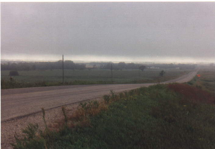
These low stratus clouds have formed by the lifting of a morning
fog at the edge of the Red River Valley. Often tall buildings or
radio towers disappear into stratus clouds.
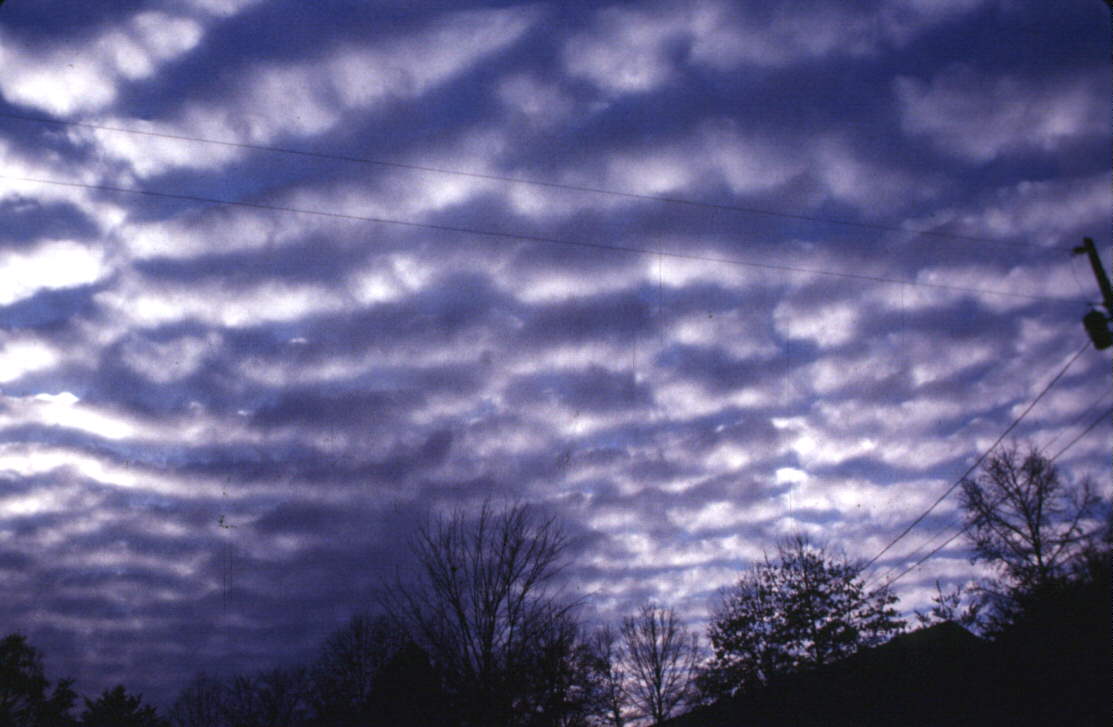
Middle level altocumulus clouds show the puffy, uneven character
of cumulo-type clouds, revealing that air at middle levels is unstable.
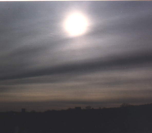
Middle level altostratus clouds often make the sun look frosty.
These clouds are often associated with advancing warm fronts, preceding
rain or snow by a few hours.

High cirrus clouds form in advance of fronts, often seen a day
or two before the front arrives. They are also a common feature of
fair-weather winter skies and make for wonderful yellow and red sunsets.
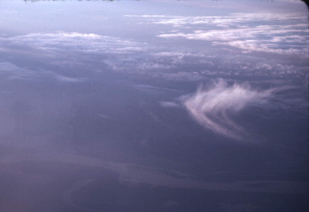
Cirrus clouds are actually snow clouds. Snow is falling
from this cloud seen from an airplane. The falling snow often gets
swept out behind the rest of the cloud as it falls into areas where the
wind is not as strong. This reveals the wind shear in the
atmosphere, an important ingredient in strong storms. This type of
cirrus cloud often resembles skis from the ground, and are sometimes called
mares tails.

Cumulonimbus clouds form in very unstable air with abundant
moisture (usually with dewpoints over about 55 degrees). These are
the clouds that produce the heaviest rain and lightning. They often
have this characteristic anvil shape when viewed from a distance.
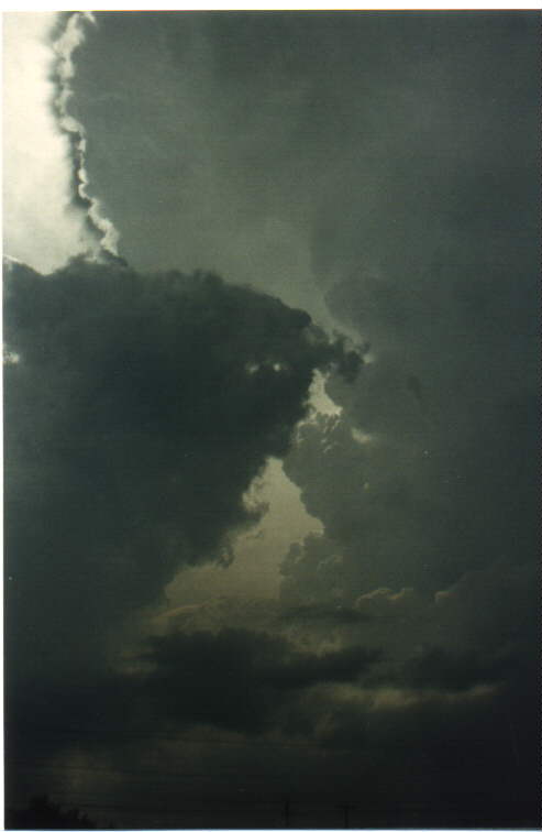
Cumulonimbus clouds viewed closer up appear turbulent and dark,
sometimes chaotic. The high cirrus clouds that often accompany or
precede thunderstorms are seen in the upper left of this picture.
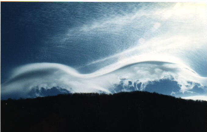
A special type of altocumulus cloud called a lenticular cloud
sometimes forms over mountains where winds blow over the mountains and
create a standing wave. I call these "flying saucer" clouds.
These formed over the Smoky Mountains.
Home Page (est.htm) Previous Page (est4a.html)