Topo Map Review
Earth Science Extras
by Russ Colson
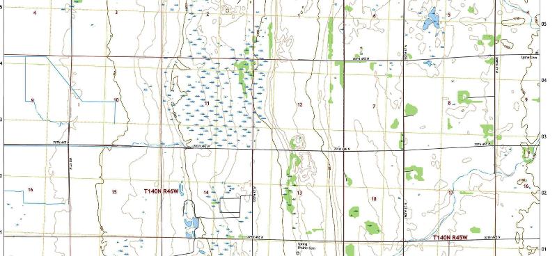
This is a segment from the United States Geological Survey 7.5 x 7.5 minute topographic profile for Hawley NW,
Exercises in interpreting topographic lines
The exercises below are intended as a review for someone who already has some experience with reading topographic lines. If you don't have this experience, you might search online for information and illustrations for reading topographic maps.

Sketch out the topographic profile for the line shown on the map below. Think about the elevations for each line that we have determined in the prevous questions and make sure that the elevations on your sketch match the correct elevations and that there are hills and slopes where there should be hills and slopes and depressions where there should be depressions.
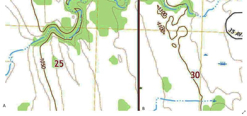
The topographic map we have been considering, portions of the Hawley NW 7.5x7.5 minute quadrangle, are at the edge of former Glacial Lake Agassiz in Northwest Minnesota. Within the area of this map, there are three distinct terrains: 1) broad, flat plain where sediment deposited in the glacial lake evened out topography and made for a mostly flat landscape, 2) A series of scarps (steep inclines similar to a ridge except that the landscape rises on one side but does not fall equally on the other side) formed where storm waves in the lake eroded into the surrounding shoreline, and 3) hummocky hill-and-pothole terrain characteristic of what is left behind by the uneven deposition of ice-carried sediment when glaciers melt. See if you can spot each of these terrains in the slightly wider viewpoint of the map below.
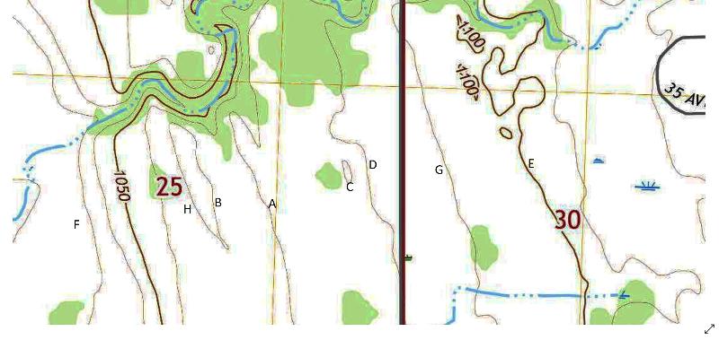
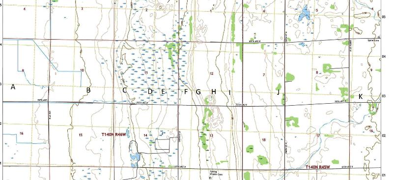
Based on the topographic profile with beach scarps marked in the previous question, try to match up the different landscape features with topographic locations in the following questions.
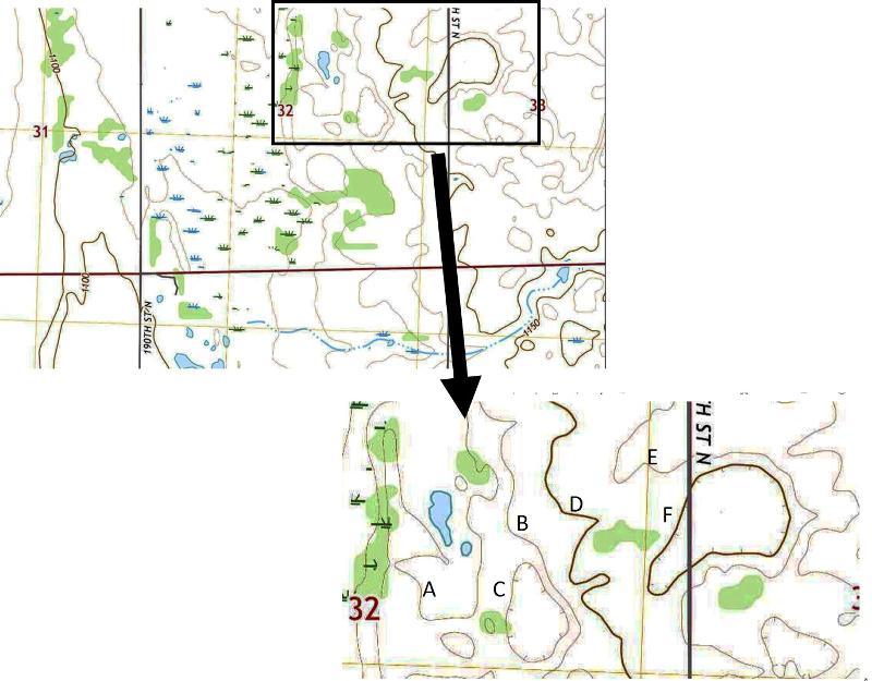
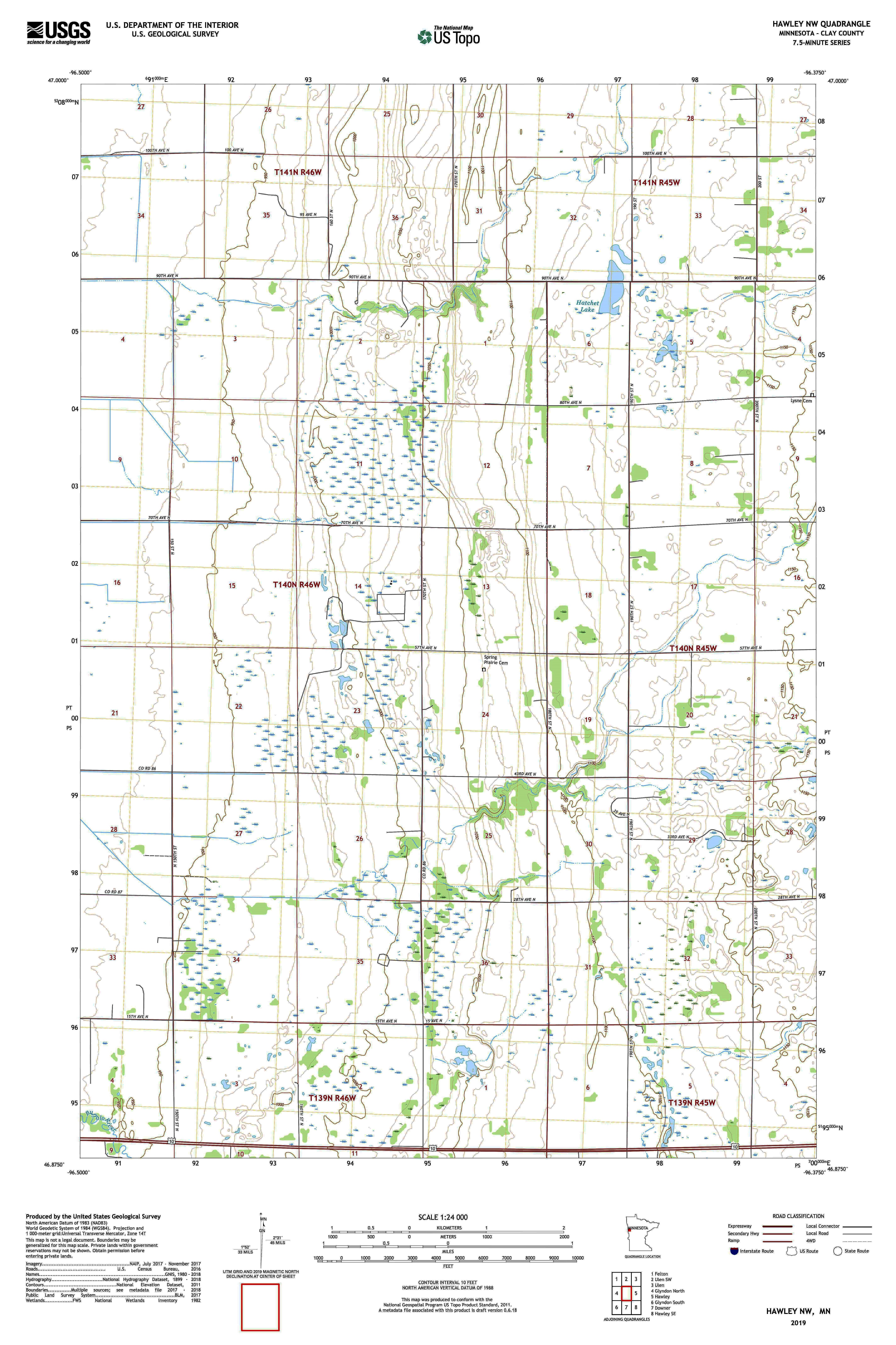
Here are some additional things you should be able to read from a topographic map. You can use the map below as an example.
What is its scale (in both verbal and fractional forms)?
What is its contour interval? What is the highest elevation on the map? What is the lowest elevation on the map? What is the relief?
What lines of longitude form its eastern and western borders?
What lines of latitude form its northern and southern borders?
What is the size of the map (in degrees, minutes, and seconds)
What is the size of the map (in miles or km)?
What is the magnetic declination?
Identify one township and range and say where it is on the map.
Can you tell where there are steeper and shallower slopes simply by looking at the map (yes)? How?
Topographic lines never cross or intersect. Explain why not.
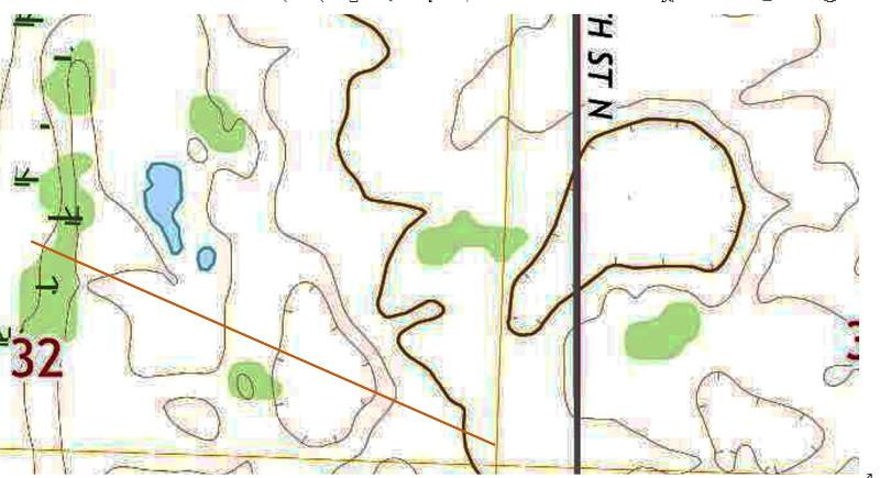
How can you tell from the topographic lines which direction a stream is flowing? Draw sketches to illustrate.
As of this writing, you can view topomaps on GOOGLE EARTH (PRO) by opening Google Earth, going to your location of interest, go to https://www.earthpoint.us/topomap.aspx (
Topo Map (earthpoint.us)click on "view on Google Earth, open the downloaded .kml file. View on Google Earth.)
last updated 1/11/2022. Text and pictures are the property of Russ Colson except for maps from the United State Geological Survey and topographic profiles drawn by Google Earth Pro.