Navigation and the Search for Longitude
Earth Science Extras
by Russ Colson
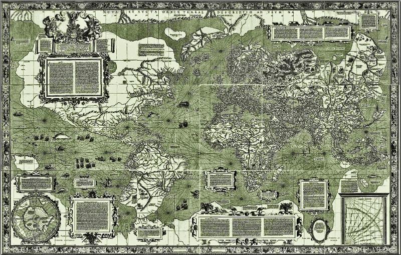
First Mercator projection map, developed for marine navigation by Gerardus Mercator 1569, titled "New and augmented description of Earth corrected for the use of navigation." public domain. The America's were still being explored and mapped at the time of this map's production.
Introduction
Geography has always been at the center of cutting edge navigational technologies. Today those technologies include Geographical Information Systems and Global Positional Systems. In the past, leading technologies included development of accurate maps and finding ways to precisely determine ones location in the open seas. Finding latitude, that is, how far north or south one is from the equator, was somewhat easier than finding longitude, that is how far east or west one is from a chosen datum. Latitude can be measured by observing how high above the horizon some celestial object is in a particular season. For example, most of us are aware that the height of the sun above the horizon at noon varies with both season and latitude. High latitudes, that is latitudes distant from the equator, experience very low angle lighting in winter and higher angle lighting in summer. Low latitudes, that is, latitudes closer to the equator, also experience variations but see higher angles of sunlight all year around. This obervation was used to calculate the size of the Earth over two thousand years ago (as I examined in another lesson on Measuring_the_Distance_to_the_Sun). However, the variation with latitude allows one tp measure of latitude when at sea by measuring the angle from the horizon to some known celestial object, such as Polaris, the north star, or the Sun at local noon. This is not without complexities. For example, the Earth is not a perfect sphere, alterning the calculation of latitude from this measured angle, and Polaris is not quite exactly over the north pole and so its position will vary by as much as a degree, requiring not-insignificant corrections. However, at the time of the great sea-faring explorations in the fourteen through seventeen hundreds, sufficiently accurate measurements of latitude per possible.
Equally accurate measurements of longitude were not possible. While the estimates of latitude based on measurements of angles to celestial bodies depends on season, calculation of longitude depends on both season and exact time. The Earth is spinning, and every 24 hours every longitudinal location on Earth will sweep past any celestial position. Without knowing the exact time relative to some chosen datum (the datum for longitude has often been chosen as Greenwhich England), longitude cannot be measured at sea.
In the past, navigators at sea used a method called 'dead reckoning' to estimate their position. This required them to estimate their rate of travel (affected by winds, ocean currents, and so on), measure their direction of travel (for example, with a compass), calculate how far they travelled each day and in what direction, and chart that trajectory on a map to keep track, day by day, of where they were in the world. Needless to say, this resulted in wide errors, sometimes dangerous ones that resulted in ship wrecks on rocky outcrops that the navigators thought they were miles, or even hundreds of miles, away from.
Thus, in 1714 the British Parliament passed the Longitude Act, offering monetary awards (up to 20000 pounds which was a good chunk of change in those days, equivalent to perhaps 100 years of average British pay in today's terms) for anyone who could provide a way to measure longitude at sea. The prize was never fully awarded, but nearly 60 years later, John Harrison was awarded a partial prize for his building and testing at sea of a very accurate clock, an effort that had taken him most of his life to achieve.
Measuring Latitude
For the exercises below, we are going to calculate latitude for some simple cases, choosing seasons that are somewhat easier to conceptualize and ignoring some complexities, like the non-spherical nature of the Earth and the 'not quite above the north pole' nature of Polaris.
Measuring Longitude
As discussed above, because the Earth rotates 360 degrees every day, it is necessary to know the exact time in order to determine longitude. Specifically, one needs to know the local 'sun' time relative to the exact time at the location of the zero-longitude datum (taken as Greenwhich England and called the Prime Meridian). Knowing only an approximate time at the Prime Meridian did not solve the problem for marine navigators. A clock that lost or gained a few seconds per day would soon be many minutes off on a long voyage, and those minutes would correspond to many miles error in location. in 1714 when the Longitude Act was passed by the British Parliament, no clock could keep time even that well. In fact, Isaac Newton had declared that no clock would likely be accurate enough to allow measurement of longitude and suggested that the best solution was to make measurements of astronomical events that could be seen from anywhere on Earth and whose exact timings were very well known.
As the race to find Longitude heated up, three methodologies rose to the top.
1) Galileo had long before discovered that Jupiter had Moons that orbitied it and that would periodically go into eclipse behind it. The movement of these bodies was very regular and predictable, and so could provide a very accurate 'clock' when one was at sea. The moons would go into eclipse at exactly the same time regardless of where on Earth one watched it from and so the time at sea could be connected to the same time in Greenwich England.
Unfortunately, it was expensive and cumbersome to have a sufficiently powerful telescope on board all ships, and the tossing of a ship in the waves, and haziness in the sky, made practical observations difficult and unreliable.
2) The Moon, Sun, and other prominent celestial bodies were easier to observe and their motions were likewise regular and predictable. Thus, the precise measurement of angular distances between these bodies could be used as a precise 'clock.' This was called the method of Lunar Distances. However, the motion of the Moon is complex, and measurement is affected meaningfully by things like deciding which part of the Moon to measure from, by refraction of the light as it moves through Earth's atmosphere causing the Moon's position appear to shift, and by parallax effects which causes more distant objects, like the sun or stars, to appear to shift less with viewing perspective than closer objects like the Moon. Tobias Mayer, competing with John Harrison for the Longitude Act prize in the later half of the 1700s, produced extremely accurate tables of the Moon's motion, including all factors such as refraction as a function of location in the sky, parallx, and complexities in the Moon's orbit, projecting several years into the future so as to be useful for future navigation. These tables were considered valuable 'high tech' stuff at the time!
However, his tables were extremely computation-heavy, and even using the tables required complex measurements and computations. Also, his tables preceded the invention of the sextant which made measurements of the relative positions of the Moon and other celestial objects both easier to do and more accurate. Even so, he was honored along with John Harrison for his contributions to the problem of finding Longitude.
3) The 'winner' of the search for Longitude was probably John Harrison who worked for decades to make an extremely accurate clock. His final clock in the last half of the 1700s was only about 5 seconds off after 81 days of voyage at sea.
Even so, his clock took years to build, and could not be easily manufactured in quantities to serve entire fleets of ships. Thus the panel awarding the Longitude prize declined to award him the full amount.
Just like the measurement of longitude in the late 1700s, modern navigation also depends critically on time. Our global GPS system, based on satellites in orbit around the Earth, must even take into account relatavistic variation in time due to the orbital speed of the satellites in order to maintain an accurate measurement of location!
Lost at a Mystery Location, a challenge in understanding ancient navigation
Although not good enough for navigation at sea, it's possible to make an estimate of your latitude and longitude with only a watch, knowledge of your time-zone offset from Greenwich Mean Time (6 hours for Central Standard Time, USA) and a careful measurement of the movement of the sun's shadow with time.
Suppose you have a vertical stake in the ground that is exactly 1 meter tall with a perfectly flat and horizontal landscape all around. For some period of time near local noon, you mark the position of the very end of the shadow of the stake, giving you, conceptually, something like the illustration below.
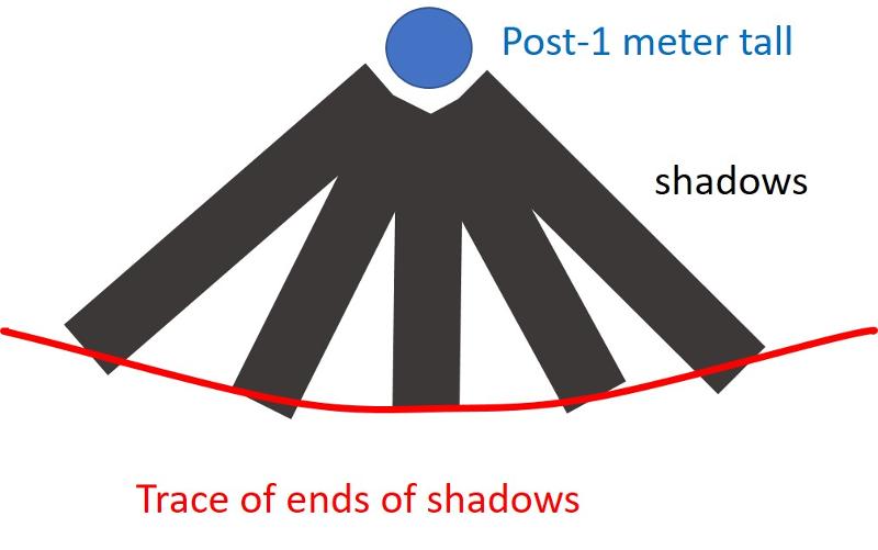
Suppose that the shortest shadow length occured at 12:11 pm local time (6:11pm GMT) and the shortest shadow length is about 2.5 meters in length. From this information, can can approximate both latitiude and longitude
last updated 11/20/2022. Text and pictures are the property of Russ Colson, except as noted.