Map Reading Exercises: A test of topographic and geologic map reading skills
Earth Science Extras
by Russ Colson
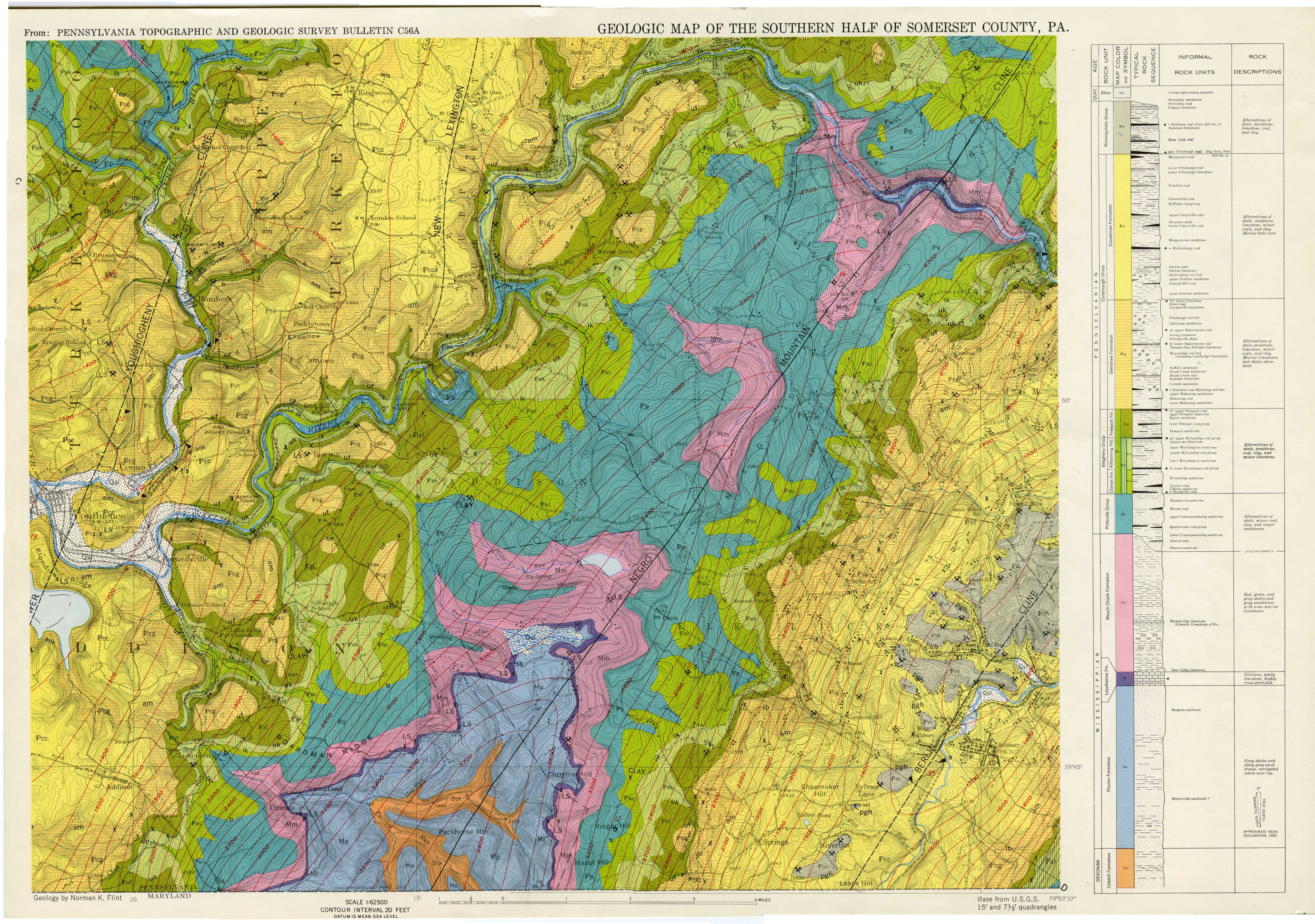
Geological map of the southern half of Somerset PA. Study this map. The questions below are to be answered from the details on this map. Clicking on the image should open up a separate image window which you may be able to navigate more easily and in which you should be able to zoom in and out.
There are at least three important types of lines shown on this map, including the contacts between rock layers, the topographic contour lines, and the structure contour lines. For many of the problems below, we are going to consider the structure contours shown on the map. Whereas topographic contours map the elevation of the topography, structure contours map the elevation of a particular surface on the map, such as the contact between two rock layers, or a particularly thin rock layer (or a fault surface). The structure contours are charting the elevation of that surface, even if that surface is below ground (lower than the topographic elevation) or has been eroded away (higher than the topographic elevation). Feel free to review structure contours if you need to.
last updated 2/14/2022. Text and pictures are the property of Russ Colson, except for the map by Norman Flint, USGS Bulletin C56A.