Stories of Other Worlds
How to Build a Landscape: Rivers and Base Level--Text
Earth Science Essentials
by Russ Colson
Lecture Recap

Base Level
Base level is the level down to which a stream can erode. We can think of it as the level at which the gravitational potential energy goes to zero. At this level, there is no longer a potential energy gradient to energize the stream and erode sediment. One typical base level is the sea. Rivers cannot, in general, erode below sea level because the standing water of the sea has insufficient energy to move the sediment. In fact, where rivers flow into the sea, sediment is typically deposited in deltas, filling the sea up toward base level. So we can also think of base level as the level to which we can fill in sediment.
A cross-sectional illustration of a river flowing to the sea is shown below.

Notice that near base level there is a region called 'sediment bypass'. In this region there is no net erosion or deposition. However, sediment is moving through this region, being transported from the area of erosion to the area of deposition. In an earlier lesson on sedimentary rocks, we considered the Hjulstrom diagram that shows regions of transport and erosion as a function of size of sediment and velocity of the river. However, at base level, it's possible to have the stream flowing fast enough to transport sediment and yet no erosion occurs because sediment is moving in from upstream at the same rate that sediment is being washed away. Where rivers flow into a standing body of water, we often form a delta as sediment is deposited up to base level. New Orleans is built on a delta—essentially at base level—which is why it is so vulnerable to hurricanes.
Other types of base levels might include lakes or layers of rock that are very resistant to erosion. On the geologically short term, a stream cannot erode below this level. Also, larger streams form the base level for tributary streams—the tributary cannot erode below the stream it flows into.
Sometimes erosion can occur below sea level—for example when dense underwater currents erode canyons in the sea bottom. Sea level is not the base level for these undersea currents because the water in the current is more dense than water in the rest of the sea, just like water in rivers is more dense than the air.
Stream Maturity
We can think of streams as existing on a scale from youthful to mature. Characteristics of youthful and mature streams are shown in both map and cross-sectional views in the figure below.

A youthful stream is one that is well above its base level and so has significant gravitational potential energy. The slope of a youthful stream is steep. Because of the steep slope, the stream is straight and erodes downward rapidly, forming 'V'-shaped canyons.
The stream below—the Tarn River in central France— is a youthful stream flowing through a V-shaped valley.

Tarn River, Central Massif, France.
A mature stream is one that has reached base level and stopped its downward erosion. Its slope will not be steep. Energy from the flow of water erodes laterally instead of downwards, causing the stream to develop meanders and gradually form a wide, flat valley called a flood plain between the bluffs on either side of the valley.
The stream below—the Little Missouri River—is still a youthful stream, however, a flood plain has begun to develop (and is not yet so wide that it's difficult to photograph) and so is more mature than the Tarn River.
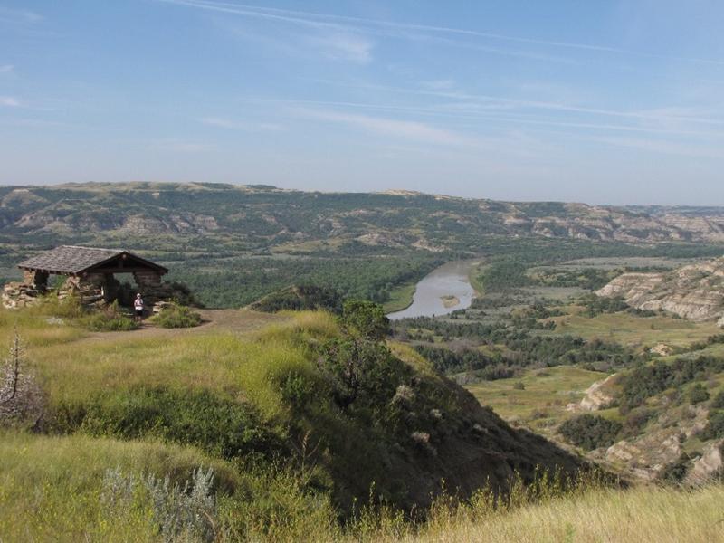
Little Missouri River Valley in the North Unit of Theodore Roosevelt National Park, ND.
The progression from youthful to mature stream is shown in map view below.

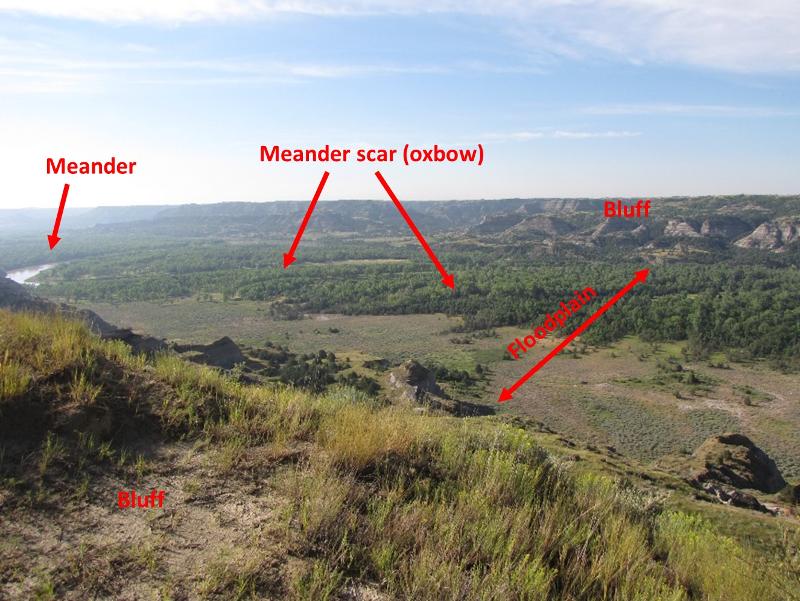
Little Missouri River, North Unit, Theodore Roosevelt National Park
The terms 'youthful' and 'mature' don't really speak to the age of the stream, although in general we expect that youthful streams will become mature as they reach base level. The Red River of the North, for example, is a mature stream but is geologically a young river. It is mature and yet young because it started out near base level and thus never went through the stage of a youthful stream. Also, sometimes a single river can have regions that are youthful and regions that are mature, as shown by the cross-sectional view below. Streams tend to erode headward, which has the effect of extending the mature part of the stream headward with time.

Puzzles in Pictures
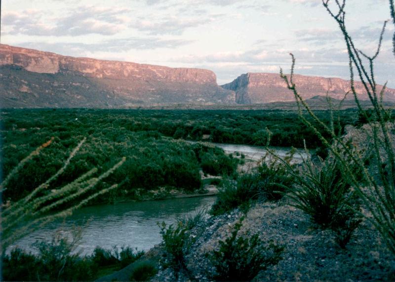
The picture above is of the Rio Grande River in Big Bend National Park, flowing from the cleft in the rock seen in the background toward the octotillo desert in the foreground. What kind of river is it?
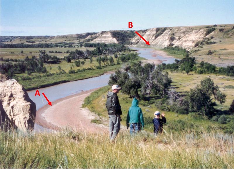
The picture above is from the Little Missouri River, western ND. We might expect that in the future we will have
Consider the river valleys shown in the three pictures below. List them in order of increasing river maturity.
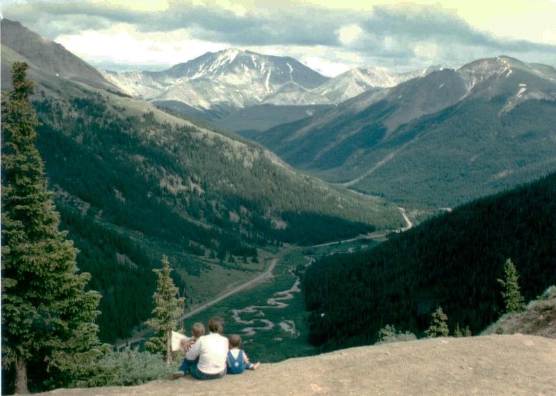
Picture A: mountain valley in the Colorado Rocky Mountains
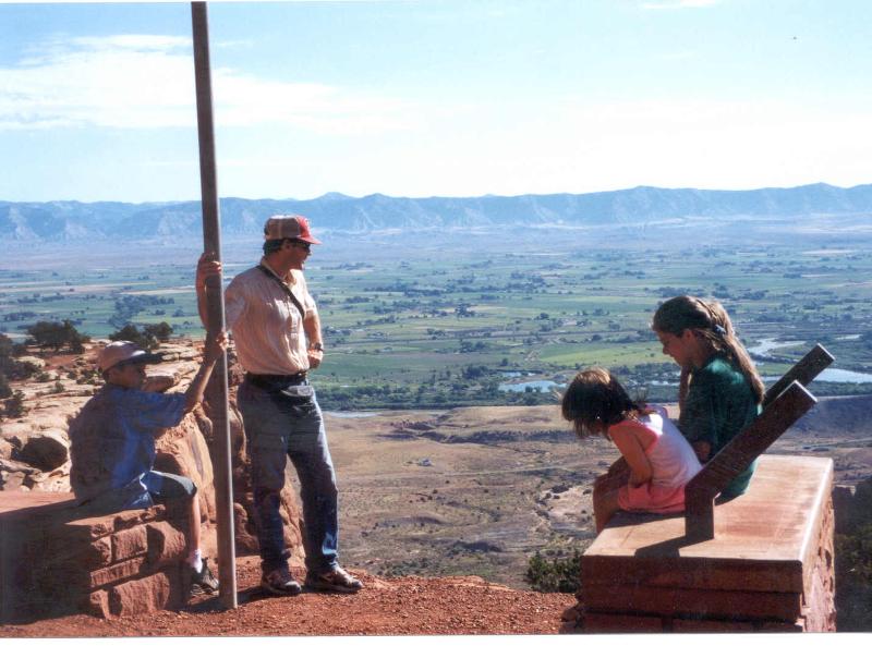
Picture B: Colorado River in western Colorado
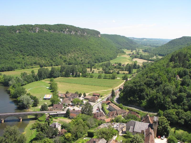
Picture C: Vallee de Ceon (whose base level is the Dordogne seen at lower left), central France.
Consider the river valleys shown in the three pictures above. List them in order of increasing river maturity.
Last updated July 6, 2015. All text and pictures are the property of Russ Colson.
.
